


 IR - CNRS
Contact : jerome.picard@cnrs.fr
Cartographer specialised in the processing, analysis and representation of spatial information. Jérôme has a degree in ethnology and a PhD in geography from the University of Paris.
Research Topics
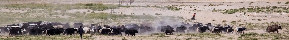
In his PhD in rural and agricultural geography, which he defended in 1999, he proposed a method of modelling the spatial relationship between animal breeding and agriculture (on different scales) on two agro-pastoral territories in northern Cameroon.
He then worked as a geomatician and cartographer on the CNRS project "Ecologie historique des Savanes soudaniennes" (Historical Ecology of the Sudan Savannas) (UMR 8586 "Prodig"). As a technical consultant in geomatics to the French Ministry of Foreign affairs in Bangui, he was appointed head of the cartography unit (2003-2008) at the University (LACCEG) where he taught geomatics and cartography for 5 years.
On a permanent contract with CNRS since February 2012 and affiliated to the Centre for Himalayan Studies (CEH, UPR 299), he also works for two other research units that specialise in languages and cultures : LLACAN (UMR 8135) and LACITO (UMR 7107).
His current activities consist in producing for researchers’ publications computerized maps, whether georeferenced or not, on multiple scales, by situating in their geographical context social and linguistic phenomena specific to African, Asian and European societies and ethnic groups. Another important aspect of his work is the compilation of georeferenced spatial databases using SIG (systèmes d’information géographique=geographical information systems) software that can be used to map social and linguistic phenomena. These georeferenced databases will be used to produce an Atlas of the Himalayan region for CEH and to map the sites where research is being conducted in Nepal within the ANR "Land-Water" project based on problem areas and on the topics discussed with the researchers involved. In addition, J. Picard is responsible for training researchers in the use of GPS and in geomatics.
J. Picard is member of the French Society for Photogrammetry and Remote Sensing (SFPT)
Keywords
![]() cartography
cartography
![]() geomatics
geomatics
![]() geographical information systems (SIG)
geographical information systems (SIG)
![]() remote sensing
remote sensing
![]() satellite images
satellite images
![]() spatial modelling
spatial modelling
![]() cartographical and temporal scales
cartographical and temporal scales
![]() rural geography
rural geography
![]() agricultural and tropical geography
agricultural and tropical geography
![]() databases
databases
![]() expertise in socio-economy
expertise in socio-economy
![]() teaching geomatics and geography
teaching geomatics and geography
![]() territories
territories
![]() sub-Saharian Africa
sub-Saharian Africa
![]() Himalayas
Himalayas
Fieldwork
![]() Central African Republic
Central African Republic
![]() Cameroon
Cameroon
![]() Congo
Congo
![]() Congo Democratic Republic
Congo Democratic Republic
![]() Kenya
Kenya
![]() French Guiana
French Guiana
![]() Nepal
Nepal
![]() Dominican Republic
Dominican Republic
Liste des publications dans HAL